Search This Blog

Tuesday, April 26, 2011

Spring weather patterns changing

Tuesday April 26 was the first morning that I can remember this spring when I woke up to a morning temperature of 70F or better.

Seventy seems to be something of a magical number.  When the nights are consistently in the seventies, a lot of plants get very serious about their spring growth.  Those warmer temperatures also bring some life to small creeks and guts which lead to the river and sound.  Last night I heard lots of jumping in the water outside my office window.  I know there are plenty of small fish swimming around the gut behind our house.

Warmer night temperatures are also favored by the palm trees and our centipede lawns.  The only thing slowing down growth of everything has been the lack of rain.  Even the Saturday that brought lots of tornadoes to North Carolina did not bring the Crystal Coast much rain.  While our friends in Roanoke, Virginia reported over four inches of rain, we got one quarter inch or less in the area.

We have enjoyed blue skies since April 17, the day after the tornadoes.  Fine weather  has been with us since then.   While we have had persistent wind, other than that it has been beautiful for most of April. Easter weekend was a great start to the beach season.  However, the net result of all the wind and no rain is that we have been rather dry.

The line of thunderstorms that rolled through the area on April 26 helped greatly.  While we didn't get a tremendous amount of precipitation, it was certainly enough to keep us going, and there are more showers in the forecast for later in the week.  Once again we had beautiful blue skies this morning, but as the day moved along, it started to look more and more like rain was coming.

In the morning, after a morning run-in with a mother killdeer,  I did my tomato plant maintenance, then mowed and trimmed the yard.  When I went in for lunch, I turned on the sprinklers since the yard was so dry.  I was well aware of the potential for rain on the evening of April 26, but I figured there was no danger of the yard getting too wet.


After lunch I cleaned our front deck, and then decided to tackle our skiff which is on a lift a few feet behind our home.  I knew that I didn't have time to completely clean the boat, but I hoped the get some of the worst dirt off it.  I was just finishing up when one of my fishing buddies showed up to visit.  Of course having a visitor put an end to any serious cleaning.

After my friend left I was just getting ready to carry everything the few feet to our garage when I noticed some dust on the side of the boat.  Likely it came from the construction site next to our home in Bluewater Cove.   Hopefully they will be finished in a month.  As I was spraying off the side of the boat, the rains came, and it was pouring before I could get everything disconnected and into the garage.

I got a little soaked, but it was a warm rain and a nice finish to a very productive day.  The rains stopped in time for me to grill some hamburgers to go along with the fresh Florida corn on the cob that my wife had purchased on the weekend.  The corn and the burgers were delicious.  We even had a pretty good hothouse tomato to go with our burgers which were dressed with lettuce from our garden.

Thursday, March 31, 2011

Spring Mornng on Raymond's Gut

Spring is a funny season whether you are on the coast of the Southern Outer Banks or the mountains of the South.  Spring often teases you with glimpses of summer, or the warmth of spring can completely disappear in a couple of hours.  You can have wonderful weather one afternoon, and then you are back in winter.

The picture at the top of the post was taken just after we had a frost that went all the down to the water in Raymond's Gut which runs behind our house all the way to the White Oak river.   I took the picture on a morning walk around the boardwalk in our community, Bluewater Cove. The fog hanging over the water is normal when there is a big temperature difference between the water and air. We see the fog especially when the water is warmer than the air.

While walking I was serenaded by many of the spring birds.  Fortunately the cold temperatures only lasted a few hours, but it was still enough that I had to cover my young tomato plants.  Because Carteret County doesn't have any rocks, I ended up buying a bag of rocks which is a hard thing to do for someone who farmed a new crop of rocks every year in Canada where we used to have a couple of farms.

While spring sometimes doesn't come in the Canadian Maritimes until May, you can count on it being here in the South by the first week of April.  I think that the latest that we have seen strawberries here on the coast is about the middle of April.

Spring is a great time on the coast.  Once we get through the pine pollen, it is possible to sleep with your windows open at night.  We can go a week at a time without the heat pumps running.  Sometimes it gets hot enough for the air conditioners to come on late in the afternoon, but we usually shut them off and let the evening breezes cool our homes.

As the waters warm they become alive with bait. We already had a week or two of that earlier in the spring.  It is a great time to be around the water, but it is a challenging time because the winds are often blowing. That means getting out on the water is something that has to be done when the conditions are right, or you miss the opportunity and end up sitting at the dock for a long time.

Later in April, it is not unusual to see winter weary northerners actually in our ocean waters.  Most of us here on the coast wait until June to get anything but our toes wet.  There are other milestones of spring.

I have already managed to catch the first fish of the season from our skiff, and I got in my first kayaking trip.  I can hardly wait until next week when the warm temperatures come back.  I will be back to exploring the beaches.  I hope to get in a five mile hike along the beaches before the end of the first week of April.

And I definitely want to get back to my uniform of shorts, tee-shirt, and crocs or Birkenstocks. Spring is definitely in the air in the South.

Sunday, March 27, 2011

More summer dreams

March has been a fickle friend to most of us in North Carolina.  While we have seen some stellar weather the third week of March, a last blast of cold air has sucked the warmth out of the land and the area's waters.

It is hard to go from shorts and temperatures in the eighties back to temperatures that seem to refuse to get out of the forties.  I was in full spring mode, taking long walks along the beach, testing the local waters for some early fish, and even paddling my kayak well out into the river.

The change in the weather did not worry me at first.  It seemed that the temperatures being called for didn't match what I was seeing.  March 25 and 26, we easily got into the sixties when the weathermen were adamant that we would not get out of the fifties.

Then the bottom fell out on Sunday, March 27.  We got up to temperatures in the mid-forties, and even worse, the temperature trended down all day.  I would not be surprised to see us in the upper thirties March 28.  That would be a very cold temperature for the Crystal Coast late in March.  I suspect the waters cooled off once again.  Once the waters have lost their heat, there is nothing to moderate the cold breezes from the north.

With cooler weather deflating my spring expectations, the only relief is to resort to dreams of summer moments that bring back warmth and the beautiful colors of the area's waters.  I know this short spell of cool weather is only a temporary setback, but it helps to visualize great summer moments while we are enduring the cold air.

One of the great trips that we took last summer was when we went out the channel from the Intracoastal Waterway to Hammocks Beach and then cut behind the beach and made our way over to the Inlet by the Point at Emerald Isle.  This large set of photos was taken to help folks unfamiliar with the area safely navigate from the ICW or dock at Hammocks Beach on Bear Island to Bogue Inlet.  They also help me forget the cold of late March.

Somehow I always associate the Point at Emerald Isle with warmth and summer. I suspect it is because I never venture over unless the weather is nice.  Thinking about good times at the Point is a great way to forget these cool spring temperature.   Another batch of photos that I like to look at when summer seems far away is this one of ocean waves that caught the light just right.

With lots of photos in my memory and the recent thought of our first fishing trip of the season, I will make it through to April which I hope brings us warmer temperatures. It cannot happen soon enough.

I checked back to last year, and it was in February that I started dreaming about beaches to keep my morale up.  In early March last year, I started thinking about boat trips. 

While I have been on the water more and earlier this year, the recent reversal in weather still means that this year the cold has continued a little longer than normal.  Last year at this time I wasn't worried about my tomato plants. Worrying about frost at the end of March pretty well fits with this year which many people are calling the coldest winter on the Southern Outer Banks in one hundred years.

Sunday, March 6, 2011

Shifting sand makes for a world that even Google cannot capture

We live in a world that perhaps except for the seas and some of the jungles has pretty well been explored.  With today's GPS systems and smart phones with built-in GPS, it would seem that not only is there little left to explore, but also there is not much of chance of not really understanding where you are.

Actually that is not the case if you are fortunate enough to live along North Carolina's Southern Outer Banks which is also know as the Crystal Coast.

I love maps and have been fascinated with them since I could barely read.  I suspect much of my reading and math ability came from being given the job of navigator at the very early age of six.  My mom was raising me as a single mom, and I got the job of getting us to and from the beach or mountains whenever we traveled.   While maps have not quite disappeared from gas stations, they have left the consciousness of most young people.

If you are under forty "mapping it" means something entirely different to them than it might to us older folks.  I have been fortunate enough in life to have traveled many places including Alaska and Newfoundland.  Mapping a trip to me often mean taking a pen and eventually a yellow highlighter and drawing a line on a paper map.  Mapping a trip today often means going to a website and plugging in two destinations and having Google, Mapquest, or Bing print out instructions on how to get there with almost no thought on your part.

There are also people, my self included, who plug a destination into their GPS or smart phone and listen to a computerized voice tell them how to reach their destination. Sometimes it turns out those directions are not exactly optimized for the best travel time.

Once when my wife and I flew by float plane into the barrens of Newfoundland in the early eighties, knowing now to plot a course on a topographic map and follow it back to our rendezvous with the little Cessna kept us from either a long arduous hike or a very cold, lonely winter in the wilderness.

The media likes to worry those of us who live near the coast have built our homes on shifting sands which disappear in the next wind storm.  While some of that goes on, there are plenty of people on the North Carolina coast who live in spots where the sand isn't shifting and the barrier islands are relatively stable.
However, there are always places along barrier islands where sand is being moved from one place to another.  The Point on Emerald Isle is one of those places.  It is where ocean currents meet river current in a swirling battle of land and water.

I first visited the Point in the early seventies.  Then the only way to reach it was take a long drive down the beach in a four wheel drive vehicle.  My uncle Austin and I did that for a day of fishing that will forever be memorable not for what we caught, but for where we caught it.  We spent most of the day on the Point and saw no other person.  Our biggest catch was a horseshoe crab.

Today the Point is much easier to reach, but it has become one of those few places where it is possible to escape the bounds of the modern world.   While you can visit it on Google maps, what you see there or on your GPS or cell phone doesn't really match what is is actually there.

Aside from me showing you my recently created map of the Point or asking one of the local who often walk or fish the  Point, you are actually on your own at the Point.  It is a huge expanse of sand that just a few years ago wasn't there.  It was only in 2008 when the access to the Point was repaired after having washed away. The water had actually taken away the dune at the end of the access ramp.  Today there is over 1400 feet of sand to the nearest water by Bogue Inlet.

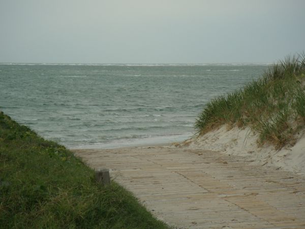
If you have a look at this picture taken in November 2007, you can get an idea of the magnitude of the change from then until March 5 when I took the picture at the top of the post.  Last summer I was amazed to see people wading just yards from the boat channel at the Point.

So in a world that is increasing mapped, fenced, out of bounds, or inaccessible to most of us, the Point at Emerald Isle offers a rare opportunity to do some real exploring.   I can tell you what it is like, but Mother Nature will make some changes each day.  At a time when kids spend far too much of their time in front of computers, a walk on the Point can teach them that there is much to learn outside of a computer screen.

While marketers are trying to convince us that we need 3D televisions, I suggest visiting the original 3D experience, the out of doors.  You might be surprised at how much everyone enjoys it.  And if they start whining about missing their iPad or Playstation, it is probably time that you locked that stuff up for a year or two.

I will give you access to my Google map that was made on March 5, 2011.  The red line is the track that I took, but it is just the outer boundary of the sand.  What looks like water on the Google map is mostly sand, and some sand on the Google map is now water.  The only way to really know what is there is to get some sand between your toes.

Even in 2011 still plenty of exploring at the Point in that huge expanse of sand mingled with the water of Bogue Inlet and the Atlantic Ocean.  We are lucky to live in such place, and those who visit and take the time to explore will be richly rewarded.

Monday, February 28, 2011

Spring weather can throw anything at us


Swansboro fogged in viewed from the White Oak River

Swansboro swallowed by the fog
Sunday morning we got up to a very foggy world.  You could hardly see the White Oak River from our clubhouse in Bluewater Cove.

It took me a while to get going anyway, and the fog certainly did not help things.  As we got ready to go church at Cape Carteret Presbyterian, the fog began to clear
.
When we left the house, the skies had cleared and our neighbor was washing his truck.  On the way out of the subdivision, we met a couple of other neighbors walking their dogs in the fine weather.  By the time we got out of our of our car after the drive of seven or eight minutes, there was no question that Sunday, February 27,  was turning into a nice day.

After church, people seem to linger in the parking lot just to enjoy the warm temperatures instead of rushing to their cars as has been the case for most of the winter. Even our minister must have wanted to get outside, since his sermon seemed a little shorter than usual.  We were almost home when I looked at the clock and noticed that it was only five minutes after noon.

We had a simple lunch of leftover orange chicken which my wife had made from a recipe in the Eat What You Love Cookbook the previous Friday evening.  After cleaing up the kitchen, we "rested our eyes" for about ten minutes, and I checked on my tiny tomato seedlings growing in my upstairs office, then we loaded some cameras into the car and headed to Beaufort.

I am in the process of revising my popular area travel guides, and I wanted to get some fresh pictures of Beaufort before I started working on the web page.  The thirty-five minute drive to Beaufort was uneventful, but it did take place under a beautiful sunny blue sky.

We parked at one the dockside parking areas, and I started wandering the mostly deserted streets and snapping pictures of some of my favorite Beaufort spots.  My wife gamely tried to guess where I might wander and keep up with me but still stay in the warmth of the sun.

There were a fair number of people in Beaufort this particular Sunday, and some of them were out on the water.  While it was five or six degrees cooler than it was in Bluewater Cove, that is nothing unusual, especially this time of year.

After tiring of snapping pictures, we loaded up and headed home.  As we often do, we made the decision to go back down the beach instead of back on Highway 24 which was the way we came.  Going back down the beach in the afternoon close to sunset can be a real challenge.  It is an interesting enough experience that I even wrote a post, Driving into the sun, about it a couple years ago.

As is our normal practice, we made a stop along the beach to enjoy some ocean air and to snap some additional pictures.  The place we stopped was just inside of the town limits of Emerald Isle and high on a dune. After examining the waves through my telephoto lens, I almost wished that I had my fishing rod with me.  There were a number of seagulls feeding on small fish close to the shore.  Still it was fairly windy and the waves would have made fishing difficult, but it was still nice to be by the ocean on a sunny afternoon.

We pulled back on the road and headed on towards Emerald Isle.  We were enjoying the brand newasphalt pavement when I noticed that the cars coming towards us had turned on their head lights.  It was only another mile or so before we also disappeared into a fog bank which seem to clear only as we crossed the bridge from Emerald Isle to Cape Carteret.  From the bridge we could see that Swansboro was also engulfed in fog.

After the short drive home, we were unloading the car when I noticed a car had pulled into the house for sale just up the street from us.  As I watched them back out of the driveway I made the guess that they were coming in our direction.  Since I am a Realtor® and have my neighbor's waterfront home listed, I decided to amble out to the flyer box in case they stopped to get one.

I wasn't surprised when they stopped, and I did answer a few questions for them.  It turned out they were already working with another real estate agent who is a fishing buddy of mine.  They were curious about boating in Bluewater Cove and on the White Oak. I  suggested a couple of places where they might find homes in their price range.  Their parting question was whether or not there was enough water at that moment to go boating.  That was an easy question to answer since I had already looked at the tide level and decided to take my boat out to try to catch a sunset picture on the river.

We are lucky in Bluewater Cove.  The wind, weather, and tides have to work really hard to conspire to take most of our water away.  It is a rare day when we cannot get out on the river.  It might not be nice out there, but there is usually plenty of water to let us get there.

It only took me about five minutes to get my gear on the boat and the GPS hooked up.  Then I headed out the inlet to the first buoy, Red Sixteen, to try for my sunset picture.  I was not very surprised to see that Swansboro was still in a fog bank.  I was pleased to see that the recent warm temperatures have raised the water temperature to 60F.   I cannot believe how fast the water has warmed.  It was down to 36F in December.

The boat ride back to the dock was short and pleasant.  Sunday night the fog has found us again.   Monday I hear we are in for some high winds and very warm temperatures.  You just never know what Mother Nature is going to throw at you here on the coast. I can take anything but snow.

You can check out a few of my Beaufort pictures that I have managed to get onto the web.  They are not labeled yet, they are still nice.   You can also see our trip to Beaufort and back on a Google map.  It is a multi-page map.  Also if you are interested, you can even view my quick boat trip on another Google map.
Finally if you want to visit the area, here is my newly updated Emerald Isle Travel Guide for 2011.

Monday, February 7, 2011

Grabbing Blue Water When You Can Find It

No one living on the Crystal Coast and in fact most of the US is going to deny this has been a tough winter.  We have seen snow here on the coast.  It is not something that is normal here, but after three shorts visits this year, people know what it looks like.

While we have warmed up from those really cold days that made our December and January average temperatures several degrees below normal, we have enjoyed some relatively warm days in February.

But as the cold weather has departed, we have ended up dealing with rain.  Friday and Saturday of the first week of February ended up as a washout.  We got about 2.25 inches of rain during the two days.  We did get warm temperatures along with the rain.

Sunday dawned with blue skies, and I was determined to get out on the water if possible.  We made our normal trip to church and took advantage of the youth group's "Souper Bowl Sunday" meal which gives you a chance to enjoy some homemade soup for a small donation.

Then we had an open house that we wanted to check out in a waterfront community over on Queen's Creek.  So by the time we were done with that it was the middle of the afternoon.  My wife wanted the fireplace turned on once we got in the house, but I resisted the urge to get in my easy chair and take a nap.

I switched to a sweatshirt and then put on my life preserver suspenders and a windproof jacket.  Then I grabbed the gear that makes for a safe boating experience. That includes a spare life preserver, a throw cushion, my emergency gear, radio phone, and our GPS.  Some of the safety gear stays on the boat even in winter, and I always have my cell phone.

It only took a few minutes to load the skiff, untie the bow line, put in the drain plug, and hook up the GPS.  Then I dropped the boat in the water and headed out Raymond's Gut which cuts through Bluewater Cove and leads to the White Oak River.

Near the clubhouse I managed to spook a great blue heron.  I noticed the water temperature had warmed a lot since my last trip in January.  Mostly the temperatures that I saw Sunday, February 6, were in the fifties.  I idled out the gut until I entered the river where I gave it a little more throttle to maintain better control in the stronger current and winds.

As I turned down river at the Red Sixteen Buoy, I moved the throttle forward and trimmed the boat until it got up on plane.  Then I backed off on the throttle just a little and enjoyed my ride across the bright blue waters of the White Oak River.  It was a pretty smooth ride considering the chop.

It was definitely not a warm summer or fall boat ride.  The air temperature this time of year close to the water is pretty close to the water temperature so I basically rode down the river at 50F traveling at 30 MPH going into a 10 MPH breeze.  I pulled my hood tight around my head, and it was not too bad.  In fact my last trip in January, I had only made it to Jones Island.  This time I made it all the way to Swansboro Harbor which is on the other side of the Highway 24 bridges.

I snapped a few pictures to go with the ones I managed on the way down and headed back up river.  The ride back up was warmer since I did not have the added breeze.  I managed to catch our neighborhood king fisher sitting in a tree on the way back to our dock.  I added his pictures to the collection that I have been working on this winter.

Since I was tracking myself with my Android phone you can see the track at one of my Google maps.  I have linked a few pictures to the map track.  Click on the camera icon, and then click on the text link to see the actual picture.

I can hardly wait until the weather gets warmer and spending more time on the water gets a lot more comfortable.

Saturday, February 5, 2011

Early morning blue sky a false hope

Well I can say that I am really glad that the blue sky that I saw early this morning was at least accompanied by warm temperatures.  Had this much moisture shown up two weeks ago, we might still be digging out from our snowstorm.  While the blue sky didn't stay with us, the warmth has.

It pretty much rained all yesterday, but when I walked out on the dock this morning the rain had stopped, and I was impressed with the temperature change.  It was a big improvement from the thirties yesterday morning when it was not only damp on the dock but also cold.  We just barely made it into the low forties yesterday afternoon.

Just before noon today, we had managed to sneak up to slightly over 60F which at least makes all the wind and rain not so bad.

We have just come out of January.  It is typically our month with the least percentage of sunshine (55%).  Even then we don't normally get two back to back days of rainfall.  The good news is that by the end of February, we are usually enjoying 60% sunshine on the way to our peak in April, so hopefully this rainfall will just be a damp memory in a week or two.

I have my tomato seeds on order,  and I am ready for spring and maybe some fishing.  I checked our rainfall gauge when I had lunch, and we are approaching 2.25 inches.  It should take care of any lingering drought here along the coast at least for a while.

There are lot of areas south of us for which this rain is very welcome.  I know a mountain valley up in Virginia which would love  this rain.   I guess we will take what we can get since we will likely need it later in the spring as the growing season starts.  If it stays warm, we could get strawberries in late March or early April, but the earlier cold weather could make them slide to later in April.

The average high for the first five days of this February  this year comes out to 57 degrees.  That is a welcome change from our recent weather.  It is nice to have some relief from the cold and ice breaking adventures.

The average high temperature for the first week of January 2011 was around 48F, but that was better than the second week of January when the average high dropped to 39F.  We have been rebounding since then.

Our normal average high in January is around 55F.  I think January 2011 had an average high of 46F, nine degrees below the normal average.  It is definitely been a cold winter everywhere.

I never would have guessed that the Dallas-Fort Worth area would be fighting five inches of snow the day before the SuperBowl.

We got one more peak at blue sky earlier this afternoon, we have now returned to wind, clouds and mist, but it is still warm.