
Actually that is not the case if you are fortunate enough to live along North Carolina's Southern Outer Banks which is also know as the Crystal Coast.
I love maps and have been fascinated with them since I could barely read. I suspect much of my reading and math ability came from being given the job of navigator at the very early age of six. My mom was raising me as a single mom, and I got the job of getting us to and from the beach or mountains whenever we traveled. While maps have not quite disappeared from gas stations, they have left the consciousness of most young people.
If you are under forty "mapping it" means something entirely different to them than it might to us older folks. I have been fortunate enough in life to have traveled many places including Alaska and Newfoundland. Mapping a trip to me often mean taking a pen and eventually a yellow highlighter and drawing a line on a paper map. Mapping a trip today often means going to a website and plugging in two destinations and having Google, Mapquest, or Bing print out instructions on how to get there with almost no thought on your part.
There are also people, my self included, who plug a destination into their GPS or smart phone and listen to a computerized voice tell them how to reach their destination. Sometimes it turns out those directions are not exactly optimized for the best travel time.
Once when my wife and I flew by float plane into the barrens of Newfoundland in the early eighties, knowing now to plot a course on a topographic map and follow it back to our rendezvous with the little Cessna kept us from either a long arduous hike or a very cold, lonely winter in the wilderness.
The media likes to worry those of us who live near the coast have built our homes on shifting sands which disappear in the next wind storm. While some of that goes on, there are plenty of people on the North Carolina coast who live in spots where the sand isn't shifting and the barrier islands are relatively stable.
However, there are always places along barrier islands where sand is being moved from one place to another. The Point on Emerald Isle is one of those places. It is where ocean currents meet river current in a swirling battle of land and water.
I first visited the Point in the early seventies. Then the only way to reach it was take a long drive down the beach in a four wheel drive vehicle. My uncle Austin and I did that for a day of fishing that will forever be memorable not for what we caught, but for where we caught it. We spent most of the day on the Point and saw no other person. Our biggest catch was a horseshoe crab.
Today the Point is much easier to reach, but it has become one of those few places where it is possible to escape the bounds of the modern world. While you can visit it on Google maps, what you see there or on your GPS or cell phone doesn't really match what is is actually there.
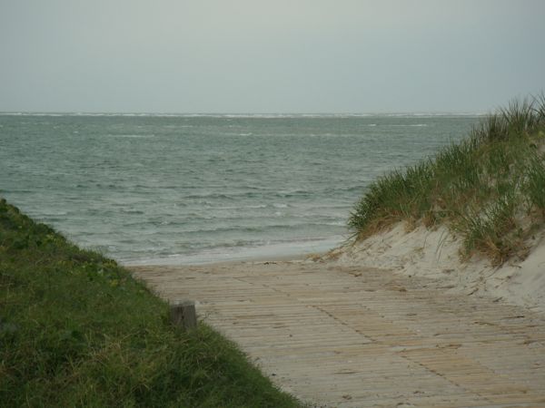
Aside from me showing you my recently created map of the Point or asking one of the local who often walk or fish the Point, you are actually on your own at the Point. It is a huge expanse of sand that just a few years ago wasn't there. It was only in 2008 when the access to the Point was repaired after having washed away. The water had actually taken away the dune at the end of the access ramp. Today there is over 1400 feet of sand to the nearest water by Bogue Inlet.
If you have a look at this picture taken in November 2007, you can get an idea of the magnitude of the change from then until March 5 when I took the picture at the top of the post. Last summer I was amazed to see people wading just yards from the boat channel at the Point.
So in a world that is increasing mapped, fenced, out of bounds, or inaccessible to most of us, the Point at Emerald Isle offers a rare opportunity to do some real exploring. I can tell you what it is like, but Mother Nature will make some changes each day. At a time when kids spend far too much of their time in front of computers, a walk on the Point can teach them that there is much to learn outside of a computer screen.
While marketers are trying to convince us that we need 3D televisions, I suggest visiting the original 3D experience, the out of doors. You might be surprised at how much everyone enjoys it. And if they start whining about missing their iPad or Playstation, it is probably time that you locked that stuff up for a year or two.
I will give you access to my Google map that was made on March 5, 2011. The red line is the track that I took, but it is just the outer boundary of the sand. What looks like water on the Google map is mostly sand, and some sand on the Google map is now water. The only way to really know what is there is to get some sand between your toes.
Even in 2011 still plenty of exploring at the Point in that huge expanse of sand mingled with the water of Bogue Inlet and the Atlantic Ocean. We are lucky to live in such place, and those who visit and take the time to explore will be richly rewarded.
No comments:
Post a Comment